 Often you see this type of marking ‘ Ordnance Arrow’ on stone structures, these are called Bench marks and are the origination of the modern use of the term benchmark when referred to as a set datum or point of reference.

Surveying Team credit: Hodgson, 1916
Before Global Positioning Systems (GPS), land was plotted and recorded using Transits (Theodolites) for angle /evelation and and metal tape for distance.
A section of angle-iron could be placed to form a “bench” for a levelling rod, thus ensuring that a levelling rod could be accurately repositioned in the same place in the future. These marks were usually indicated with a chiselled arrow below the horizontal line.
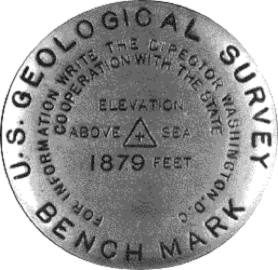
The height of a benchmark is calculated relative to the heights of nearby benchmarks in a network extending from a fundamental benchmark. A fundamental benchmark is a point with a precisely known relationship to the level datum of the area, typically mean sea level.(credit. Wikipedia)
 Other bench marks are Flush brackets (as shown), these are Triangulation points or trig points. These points may be marked by disks similar to benchmark disks, but set horizontally, and are also sometimes used as elevation benchmarks.
 Prominent features on buildings such as the tip of a church spire or a chimney stack are also used as reference points for triangulation. In the UK triangulation points are often set in large concrete markers that, as well as functioning as triangulation points, have a benchmark set into the side. (credit. Wikipedia)
In the UK there is a database of these bench marks which can be found at bench-marks.org.uk. The database also allows users to confirm and add bench marks when found.
Could these be of some use should the GPS ever become unavailable?
I found the following interesting data from a Land Surveyor; Dave Davies (Bedfordshire, UK)
Benchmarks come in 3 levels of accuracy:
- 3rd order which are by far the most numerous and mostly the “Ordnance Arrow” cut into walls and buildings, but on culvert headwalls or parapets they can also be dome-headed bronze rivets and some rarer weird types like sockets cut in the stonework which take a ball bearing of a particular size.
Most cut arrows are a standard size, if you find a particularly large and irregularly cut one it’s probably one of the very early ones (1800’s) that originally had a quoted level on Liverpool Datum, not the modern Newlyn Datum. Churches sometimes have one of each. - 2nd order, mostly flush brackets. These are all uniquely numbered so make a good answer to prove that a team have actually found it if you can include one in an incident hike. You don’t need to visit it to get the number yourself, they’re on the OS website lists referred to previously.
- 1st order sometimes known as fundamental benchmarks. There are a few 1st order flush brackets on the primary triangulation pillars, but often 1st order BMs are buried out of harms way because they are non-ferrous bolts in concrete blocks or piles founded on bedrock.
Until recently these were still maintained by OS because they give a very accurate indication of how much the land mass is moving over time.
A trig pillar symbol on the map where there is no pillar on the ground doesn’t necessarily mean it’s been destroyed because some of these were buried marks too. Sometimes they had to be positioned for visibility reasons in places where a pillar would have been likely to get damaged or it was in the landowner’s way. Before GPS it used to be great exercise digging trying to find them when the OS reference dimensions related to walls and fences that weren’t there any more
Apart from the first order trig pillars and possibly the 1st order benchmarks, OS don’t resurvey either horizontal or vertical control any more to check for movement, or periodically verify it’s existence. That stopped in the 1970’s for cost reasons and then for a while they relied on private surveyors who used the marks to tell them when something had been destroyed. Although OS regard most pillars and benchmarks as redundant now that GPS is almost as accurate, benchmarks particularly are still very much in use by working surveyors on smaller jobs because it’s rather OTT to take £30k worth of GPS kit to a site when there’s a free benchmark down the road.

